AI is a critical part of what makes Google Maps so helpful. With it, we’re able to map roads over 10 times faster than we could five years ago, and we can bring maps filled with useful information to virtually every corner of the world. Today, we’re giving you a behind-the-scenes look at how AI makes two of the features we announced at I/O possible.
Teaching Maps to identify and forecast when people are hitting the brakes
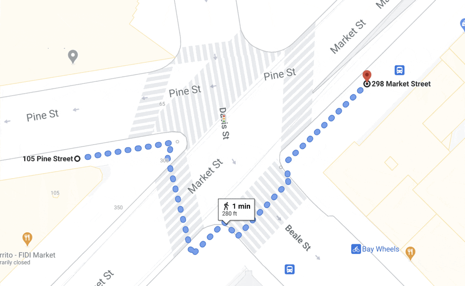
Let’s start with our routing update that helps you avoid situations that cause you to slam on the brakes, such as confusing lane changes or freeway exits. We use AI and navigation information to identify hard-braking events — moments that cause drivers to decelerate sharply and are known indicators of car crash likelihood — and then suggest alternate routes when available. We believe these updates have the potential to eliminate over 100 million hard-braking events in routes driven with Google Maps each year. But how exactly do we find when and where these moments are likely to occur?
That’s where AI comes in. To do this, we train our machine learning models on two sets of data. The first set of information comes from phones using Google Maps. Mobile phone sensors can determine deceleration along a route, but this data is highly prone to false alarms because your phone can move independently of your car. This is what makes it hard for our systems to decipher you tossing your phone into the cupholder or accidentally dropping it on the floor from an actual hard-braking moment. To combat this, we also use information from routes driven with Google Maps when it’s projected on a car’s display, like Android Auto. This represents a relatively small subset of data, but it’s highly accurate because Maps is now tethered to a stable spot — your car display. Training our models on both sets of data makes it possible to spot actual deceleration moments from fake ones, making detection across all trips more accurate.
Understanding spots along a route that are likely to cause hard-braking is just one part of the equation. We’re also working to identify other contextual factors that lead to hard-braking events, like construction or visibility conditions. For example, if there’s a sudden increase in hard-braking events along a route during a certain time of day when people are likely to be driving toward the glare of the sun, our system could detect those events and offer alternate routes. These details inform future routing so we can suggest safer, smoother routes.
Using AI to go beyond driving
When you’re walking or biking or taking public transit, AI is also there helping you move along safely and easily. Last August we launched detailed street maps which show accurate road widths, along with details about where the sidewalks, crosswalks and pedestrian islands are in an area so people can better understand its layout and how to navigate it. Today, we announced that detailed street maps will expand to 50 more cities by the end of 2021. While this sounds straightforward, a lot is going on under the hood — especially with AI — to make this possible!
A before and after comparison of detailed streets maps built from satellite imagery
Imagine that you’re taking a stroll down a typical San Francisco street. As you approach the intersection, you’ll notice that the crosswalk uses a “zebra” pattern — vertical stripes that show you where to walk. But if you were in another city, say London, then parallel dotted lines would define the crosswalks. To account for these differences and accurately display them on the map, our systems need to know what crosswalks look like — not just in one city but across the entire world. It gets even trickier since urban design can change at the country, state, and even city level.
-
A street-level picture of crosswalks in San Francisco
Crosswalks in San Francisco
-
A street-level image of crosswalks in London
Crosswalks in London
-
A street-level image of crosswalks in Tokyo
Crosswalks in Tokyo
-
A street-level image of crosswalks in Madrid
Crosswalks in Madrid
-
A street-level image of crosswalks in Zurich
Crosswalks in Zurich
To expand globally and account for local differences, we needed to completely revamp our mapmaking process. Traditionally, we’ve approached mapmaking like baking a cake — one layer at a time. We trained machine learning models to identify and classify features one by one across our index of millions of Street View, satellite and aerial images — starting first with roads, then addresses, buildings and so on.
But detailed street maps require significantly more granularity and precision than a normal map. To map these dense urban features correctly, we’ve updated our models to identify all objects in a scene at once. This requires a ton of AI smarts. The model has to understand not only what the objects are, but the relationships between them — like where exactly a street ends and a sidewalk begins. With these new full-scene models, we’re able to detect and classify broad sets of features at a time without sacrificing accuracy, allowing us to map a single city faster than ever before.
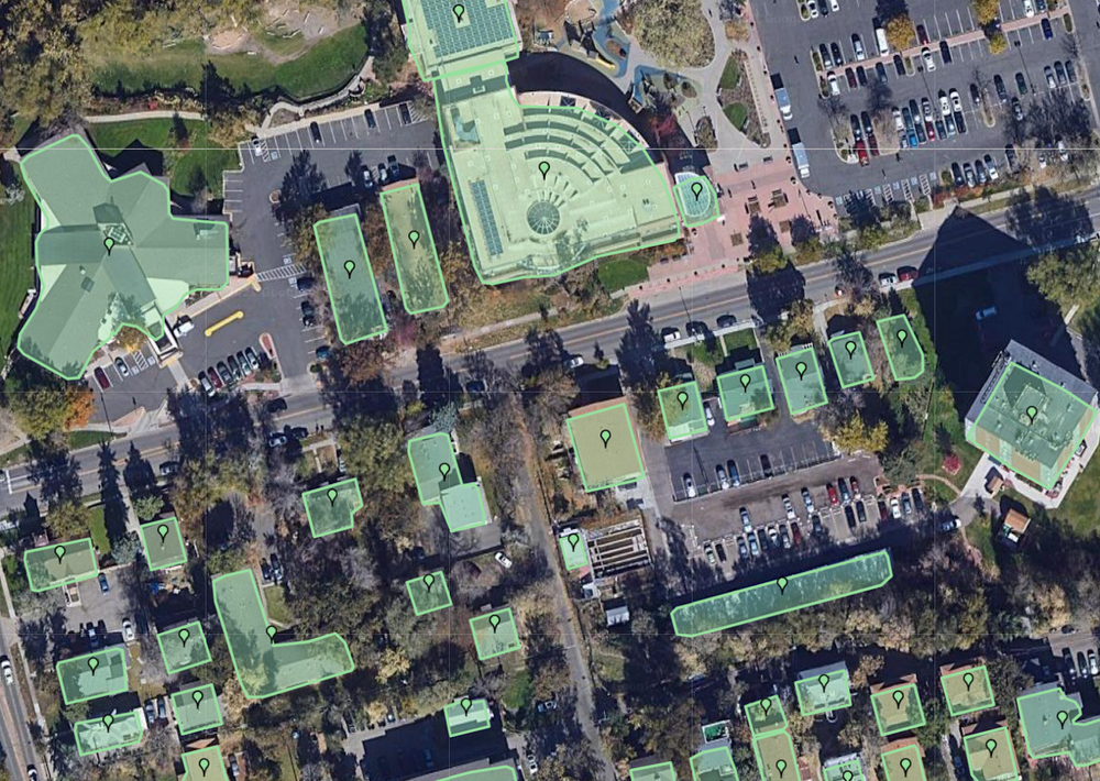
Single-feature AI model that classifies buildings.

Full-scene AI models that capture multiple categories of objects at once.
Once we have a model trained on a particular city, we can then expand it to other cities with similar urban designs. For example, the sidewalks, curbs, and traffic lights look similar in Atlanta and Ho Chi Minh City — despite being over 9,000 miles away. And the same model works in Madrid as it does in Dallas, something that may be hard to believe at first glance. With our new advanced machine learning techniques combined with our collection of high-definition imagery, we’re on track to bring a level of detail to the map at scale like never before.
AI will continue to play an important role as we build the most helpful map for people around the globe. For more behind-the-scenes looks at the technology that powers Google Maps, check out the rest of our Maps 101 blog series.
Maps 101
Google Maps helps you navigate, explore, and get things done every single day. In this series, we’ll take a look under the hood at how Google Maps uses technology to build helpful products—from using flocks of sheep and laser beams to gather high-definition imagery to predicting traffic jams that haven’t even happened yet.